Pitons du Carbet

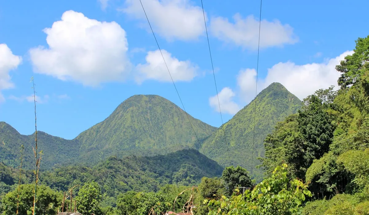
The Pitons du Carbet are located in the north of Martinique. The Pitons du Carbet are believed to be Martinique's oldest mountain range, dating back further than Mount Pelée, Martinique's highest peak. There are five mountain ranges grouped in a small area. They are of volcanic origin, and the highest of the five, Piton Lacroix, rises to 1,196m. Along with Mount Pelée, they are the island's most beautiful natural observatory. On September 30, 2023, the volcanoes and forests of Montagne Pelée and the Pitons of northern Martinique were admitted as a Unesco World Heritage Site.

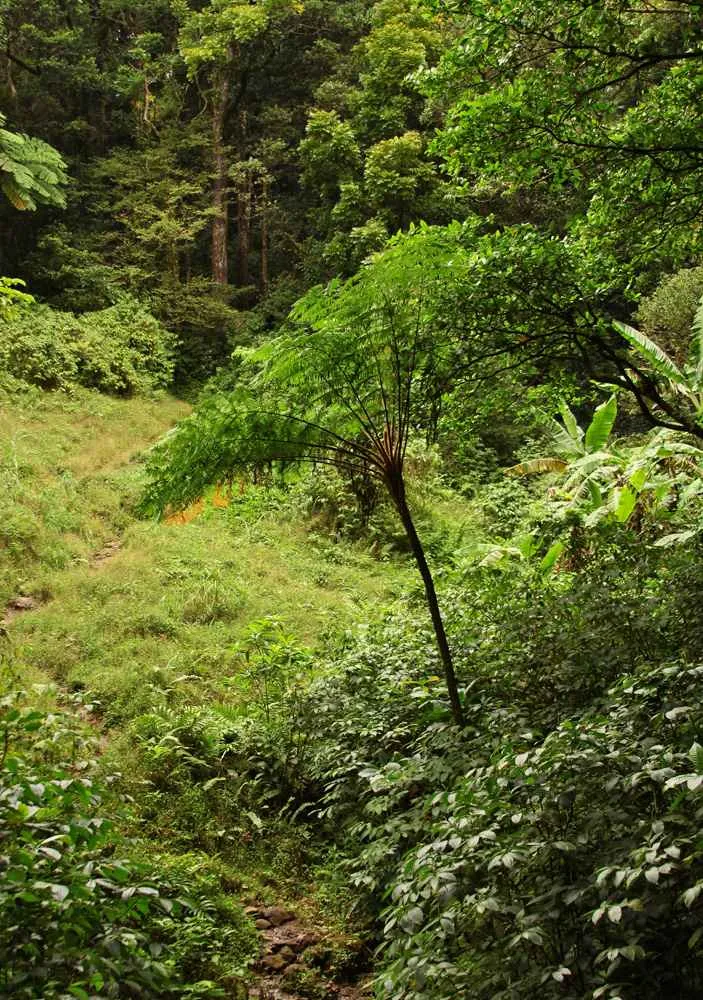
This region is characterized by a thick tropical rainforest with tall tree ferns, anthuriums, heliconia, and bamboo. From an altitude of 800 meters (2,625 ft), the vegetation becomes less dense, revealing magnificent panoramic views over the island.

The five Pitons du Carbet are:

  • Piton Lacroix or Morne Pavillon (1,196 meters or 3,924 ft)
  • Piton de l'Alma (1,105 meters or 3,625 ft)
  • Piton Dumauzé (1,109 meters or 3,638 ft)
  • Piton Boucher (1,070 meters or 3,510 ft)
  • Morne Piquet (1,160 meters or 3,806 ft).

Trees reach heights of 30 to 40 m, and sometimes 50 m, and often have wide buttresses to consolidate their footing. Tree ferns in these forests can reach 15 m in height. After 1,000 m, the rainforest is replaced by thickets and savannahs. The hike up the pitons is very long.

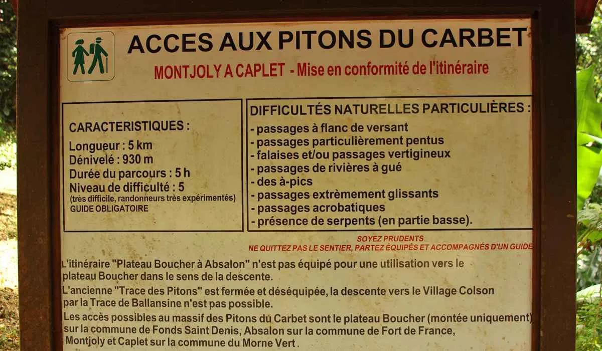
So plan to get there very early in the morning (as early as 5 AM) if you want to complete the entire route. And don't forget food and water. There's nowhere to buy food in the area. For an unforgettable souvenir, bring your camera, as Morne Piquet offers a magnificent 180° panorama of Montagne Pelée and the Atlantic and Caribbean coasts.

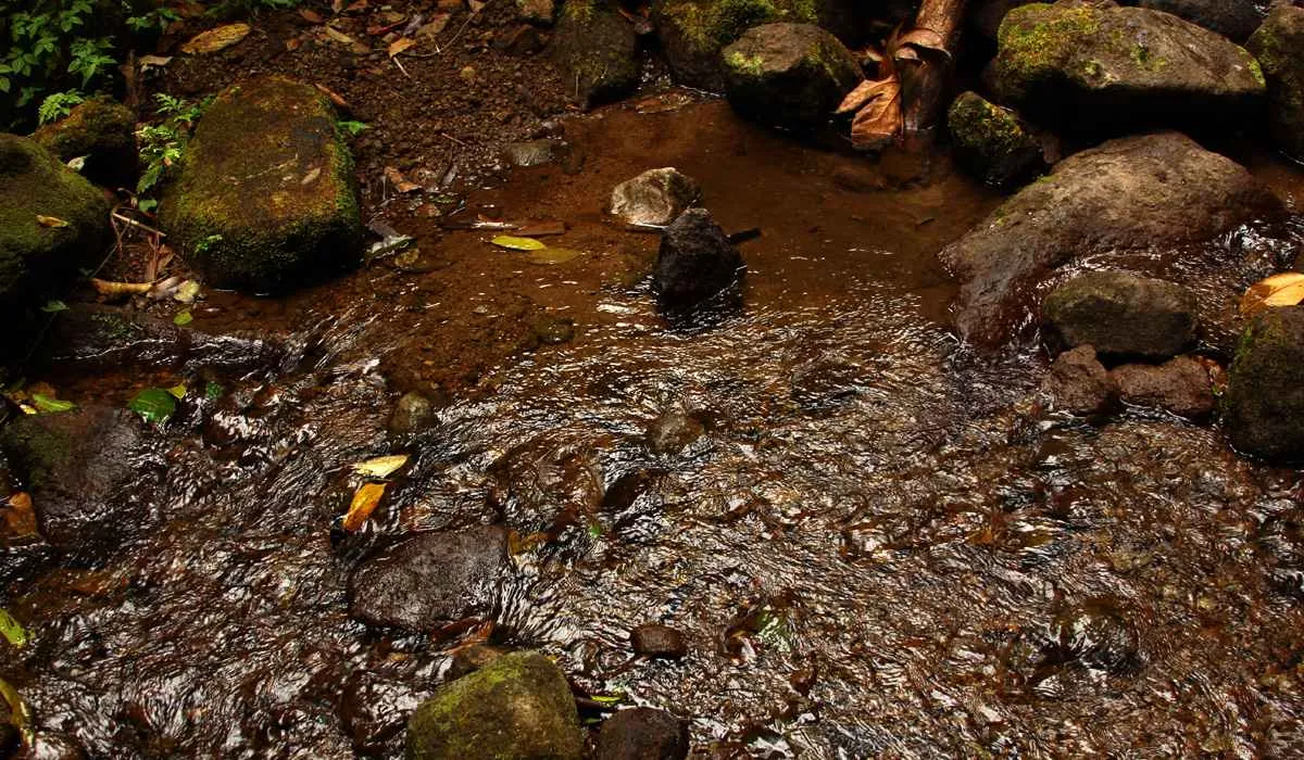
Bring hiking boots and a raincoat, as it often rains. To get there, head for the North Caribbean. Between the towns of Le Carbet and Saint-Pierre, the signposts are easy to find.

Photo gallery
Pitons du Carbet
Pitons du Carbet
River at Les Pitons du Carbet
Pitons du Carbet
Pitons du Carbet
Pitons du Carbet
Pitons du Carbet

Mount Pelee

At 1,397 meters (4,583 feet) above sea level, Mount Pelee (Montagne Pelée in French) is Martinique's highest point. The volcano is still active and left an indelible scar when it erupted on May 8, 1902.

Its eruption is said to have killed over 32,000 people and destroyed the town of Saint-Pierre, then the capital of Martinique. The uniqueness of its eruption has even led to its name being used today to characterize a type of eruption (pelean eruption). Although many claim that Mount Pelée is located in Saint-Pierre, the volcano is actually in the commune of Morne-Rouge.

On September 30, 2023, the volcanoes and forests of Montagne Pelée and the Pitons in the north of Martinique were declared a UNESCO World Heritage Site.

If you're looking for a breath of fresh air, this is the place to be in Martinique. Indeed, at its summit, it would be around 10°C, the lowest temperature you'll find on the island. The further up the mountain you climb, the cooler it gets.

Its summit, known as "Le Chinois", rises to 1397 meters and is only visible for an average of seven days a year! So it's extremely rare that the clouds don't hide it, revealing its full contours.

Bring hiking boots and a raincoat, as it rains almost every day. On sunnier days, it can also be very hot, and the sun beats down more and more as you climb, so don't forget your cap or hat and plenty of water.

The climb up Mount Pelée takes around 5 hours, or even 6 hours if you plan to reach the summit. To get the most out of the site, plan to go very early in the morning (from 5 or 6 AM). You can choose to climb via the Aileron or the Grande Savane. Only the most experienced hikers/climbers can hope to reach the summit.

On the way back, you can stop off at the small restaurant bar in the parking lot to refuel before setting off again.

To get there, head north to Martinique, and once you've arrived in the commune of Morne-Rouge, head towards Ajoupa-Bouillon, taking the Route de l'Aileron to the parking lot of the 1st refuge (822 m). This first route leads to the 2nd refuge (1250 m) on the edge of the Caldeira. The signs will show you how to get there quite easily.

Photo gallery
Mount Pelee
Mount Pelee
Mount Pelee
Mount Pelee
Mount Pelee
Mount Pelee
Mount Pelee
Mount Pelee
Mount Pelee
Mount Pelee
Mount Pelee
Mount Pelee
Mount Pelee
Mount Pelee